|
|
 |
The Land
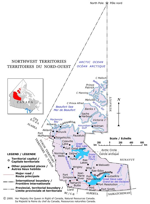
The Northwest Territories (N.W.T.) lie north of the 60th parallel,
above Saskatchewan, Alberta, and eastern British Columbia, and between the Yukon
and Nunavut. These dimensions represent a recent change. With the creation of
Nunavut on April 1, 1999, the area of the former Northwest Territories, which
stretched from the Yukon east to Baffin Island and included all of the Arctic
archipelago, was reduced by approximately two-thirds, from 3 426 320 km2
to 1 171 918 km2.
This is not the first time that the Northwest Territories has undergone dramatic boundary changes. At one point or another during the N.W.T.'s history, it has included all of Alberta, Saskatchewan and the Yukon and most of Manitoba, Ontario and Quebec.
Like the Yukon, the Northwest Territories can be divided into two broad geographical regions: the taiga, a boreal forest belt that circles the subarctic zone; and the tundra, a rocky Arctic region where the cold climate has stunted vegetation. Remarkable features include the Great Bear Lake (31328 km2 , eighth largest in the world); the Great Slave Lake (28 568 km2, tenth largest in the world); and the Mackenzie River (Canada's longest), which flows 4241 km from the Great Slave Lake to the Beaufort Sea.
![]()